Geologic Boundaries & Structures
Geologic Structures
The structures found on the Earth make it possible to understand the dynamic nature of the Earth. It helps us know the forces that caused the upwelling and down-warping of the Earth. In a hydrogeological context, geologic boundaries and structures impact how water gets stored or flows within the Earth's surface. The development of these structures is influenced by the variation in the properties of the Earth's crust. Groundwater is usually stored in openings beneath the Earth. The openings can be in igneous, metamorphic or sedimentary environments. In hard rock domains such as igneous and metamorphic environments, geologic boundaries and structures are crucial when one is searching for groundwater resources. The proper siting of a water well in such an area will largely be determined by the correct mapping and location of these structures.
Hard Rock Domains
A hard rock domain is a geologic environment dominated by consolidated rocks. Such an area has metamorphic and igneous rocks, and the possibility of groundwater occurrence in the area is pegged on the existence of well-connected geologic structures. In a hard rock domain, one is likely to find fractured rock aquifers or weathered aquifers, with sediments overlying a basement rock complex.
Follow this link to read more about fractured aquifers
Types of Geologic Structures
Fractures, folds, caves, vugs, bedding planes and lineaments are some of the most important structures and geologic boundaries that influence groundwater occurrence in a hard rock domain. Fractures are further divided into three subclasses; joints, fissures, and faults. It is imperative to point out that these structures influence the secondary porosity of these formations. Secondary porosity is controlled by the degree to which the arrangement and number of fracture openings are filled with sand/sediments. Secondary porosity forms after the formation of a rock, whereas primary porosity results during the formation of the rock. Most consolidated rocks exhibit secondary porosity.
Faults & Lineaments
A break that exists between two blocks of rock produced by tension, compression, or shear stress is known as a fault. The size ranges from micrometres to thousands of kilometres, lengthwise and also in depth. They are evidence of the existence of tectonic activity in an area. Faults could influence groundwater in one of the following ways:
First, the material near a fault plane may develop fractures and openings that create more pathways that necessitate the flow of groundwater out of the aquifer zone, or provide more storage. Secondly, if the precipitation occurs in an existing fracture, then it will lead to a reduction in the secondary porosity. This limits the movement of groundwater resources. Thirdly, faults disconnect aquifers and in turn, obstruct horizontal groundwater flow, which could influence water availability in an area.
Follow this link to read more about fractures
Dykes
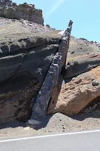
Geologic structures or rocks that cut into existing rocks are known as dikes. They can also cut through the fractures and can be of magmatic or sedimentary origin.
Folds
Basin and Domes
Impact of Geologic Structures on Groundwater
- Create zones of low permeability (barriers)
- High permeability zones (conduits)
- Lineaments used to infer groundwater flow path and storage
- Faults act as conduits and make rocks excellent aquifers.
- Dikes act as barriers thereby preventing salt-water intrusion
- Dikes can also can also divert groundwater flow mechanism


